Name of the State Depicted on Coin
2021-07-27 Tue
Rampura Princely state was a part of Rohilkhand of United Provinces. It covered an area of 893 square miles. The state’s boundaries were bounded by Naini Tal in the north, Bareilly in the east, Budaun in the south and Moradabad in the west. Ramganga River flows from northwest to south-east across the southern part of the state. The other two important rivers of the state were Koshi and Nahal. It is rich in alluvial soil with hardly any rocky land. The commonly found animals of this region were leopard, tiger, hog, antelope, nilgai, hares, partridges, quail, wild duck, florican and small sand grouse.The early history of the state is similar to that of Rohilkhand. During the 17th century, both the brothers, Shah Alam and Husain Khan joined the service of the Mughal Emperor. Daud Khan, son of Shah Alam joined Marathas army and received a grant of land near Badaun. In 1719, his adopted son, Ali Muhammad received the title of Nawab and a grant of a bigger part of Rohikhand agency.
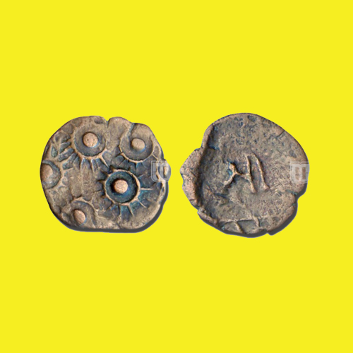
The copper paisa of Rampura depicts sunburst on the front side and ‘Sri Rampura’ legends in Devanagari on the backside.
Image Courtesy: Mintage World
Latest News
-
Mahatalavara’s Copper Coin from Costal Andhra / Telangana region
2026-07-20 Mon -
Maharathis - Extremely Rare Lead Coin of Chitradurga
2026-07-20 Mon -
Uniface Coin of City State Tripuri
2026-07-18 Sat -
Copper Punch Marked Karshapana of City State Eran
2026-07-18 Sat -
Rare Copper Coin of Chandra Gupta II
2026-07-17 Fri